Thursday, July 3, 2014

71>71 North & South Twin July 1, 2014

Prior to this hike I had always approached the Twins from the south via Twinway to South then the spur to North.  This was my first time from the north via North Twin Trail.  The first and last thirds of the climb were fun.  The middle third was not --- it was long, steep, buggy, muggy and hot!  Needless to say, I have few photos of the middle.  I was too busy then swatting flies and wiping sweat from my eyes.
The ridge walk between North and South Twin was special (as are most all ridge walks.)  Near the end of the trip down I took the "high water" alternate route avoiding two crossings I had made on the way up.  I am glad I did.  I found a very large stand of Pink Lady Slippers (even though most were past bloom) and the "little tree in the trail" that marks the take off point for the unmaintained, but often used, Firewarden's Trial up Mt Hale.  Something I have heard about, but never known just where to find it.  Now I know!
A few photos of the trip are below  The smudge on the lens was from some misapplied insect repellent!


Little River along the approach

Up


The ridge walk


an interesting scramble


South Twin from North twin Spur trail


South Twin summit


Mountain Cranberry


Labrador Tea


?


Pink Lady Slipper


"Little Tree in the Trail"


Monday, June 23, 2014

71>71 Jefferson June 23, 2014

Caps Ridge!  This trail is high on my favorites list.  A walk in the woods is nice --- but being above treeline puts me in a mood I'm not able to experience anywhere else..  Caps Ridge Trail gets me up out of the woods quickly.  And then I get to scramble over rock and ledge looking for a hand hold here and there ------ oh yes, I'm a real mountaineer!  It's short enough so that none of it feels tedious --- and the summit cone, even with it's boulder hopping, seems easier than the middle.  Yes, Caps Ridge has a lot going for it.
I was up there today with the intent (and hope) of finding the alpine flowers on Montecello Lawn in heavy bloom.  I make a loop over to Gulfside and then Cornice back to Caps Ridge.  This route keeps me above treeline a bit longer and gets me off some of the boulders and down into the grasses and sedges where there is soil enough for the alpines.  A few more days of warmer weather should pop out some patches of color.  There was little today.
There was sunshine and warm temperatures and a comfortable breeze and only a few bugs --- a stellar day!  (But, speaking of "bugs," ------- can anyone reading this tell me the name of the gigantic flies that appear to guard the summit rock on Jefferson?  They look like a cross between a Horse Fly, Yellow Jacket and Vampire Bat!  I didn't linger long at the actual summit for fear of bodily harm!)

I've posted photos of this hike before and other posters, on a number of hiking forums, have very good recent pictures of this same hike.  I'll try not to repeat their great work.  But for the non-hikers reading this, here are a few photos to give a flavor of the day:

Jefferson summit


Not sure why I think bog bridges are so photogenic.  But I can't pass up a picture of one!


A unique bunch of pot holes are in a ledge along the trail miles from any brook.

Straight ahead


over these.

Washington  summit across Montecello Lawn


Bunch Berry

Clintonia

Mountain Cranberry

Cinquefoil

Blueberry

And the Mosses with fruiting sporangia are interesting

Club Moss

The decent.

Thursday, June 12, 2014

71>71 North Carter June 12, 2014

Today's hike up North Carter was mostly in the rain ----- and there is a story behind that.
Anyone with an observant eye reading these posts may have noticed that all my hikes have been in good weather --- some in stunningly beautiful weather!  That has been by design.  Being retired, I can pick my days --- and why not pick the very best?
Yet, it happened that the only day this week I could be away was Thursday.  The weather forecast for Thursday did not look good. My first thought was to can it.  Really, why get wet when I don't have to?
But on the other hand ---------- why not?  Life, after all, is not all sunshine.  I've been out in the rain before.  I've been soaked through before.  I've put up with boots full of water and rain dripping off my nose before.  Damn, I've been missing some real life experiences by picking only sunny days for my hikes!  Book the hike for Thursday come hell or high water.  So I did.
Up at 5:00 am to a steady drizzle.  The drive over to Pinkham Notch in a heavier rain.  Throwing the pack on my back at the Imp Trailhead in a mist.  A steadier rain and wet brush along the trail through most of the hike up.  Windy and cold at the summit ledge.  Drier on the hike down but more rain on the short road walk between South and North Imp Trail heads and all the way home.  I was wet but not soaked through nor at all uncomfortable.
The hike was a bit more challenging than some others.  I spent a lot of time concerning myself with foot placement --- wet is slippery!  I was reminded that Vibram soles are not magic --- their lugs need nubs to grab hold of.  Smooth rubber on smooth rock, with a film of water in between is to be avoided.  And especially, do not let an instep land on a sloping wet root ----- disaster on a stick!
My gear had to be organized differently compared to a sunny day too.  The camera spent most of it's time tied up in a plastic bag ----- so there are fewer photos of this hike to post.  That's too bad --- I would have liked to have shared more of this experience with you.


Madison & Adams from The Imp face

Looking down on a nearly vertical Imp Brook from The Imp face.

on the ridge

North Carter summit

Washington form South Imp Trail


Thursday, May 29, 2014

71>71 Garfield May 29, 2014

What a day to be on Mt. Garfield!  A comfortable temperature, gentle breeze, practically no bugs, few other  people, wildlife, wildflowers, and skies clear enough to suck your eyeballs out!  Garfield is the pointy peak that shows up so prominently to the northeast of Lafayette.


I went up and back on the Garfield Trail from the north.  It's a 10 mile round trip with mostly moderate grades.  Much of the trail follows an old tractor road used during the 1940's to access a fire tower.  A concrete foundation still remains on the summit ledges and I found one telephone pole about half way up the trail.


I love being in the woods in Spring.  I find myself "looking" more during this season --- there's so much to see!  I've been through a few Springs during my lifetime and still I don't tire of them.  I think I like the newness of it all.  Lucky me!
Some of today's wild flowers:

Wood Anemone

Rose Mandarin

Trout Lily


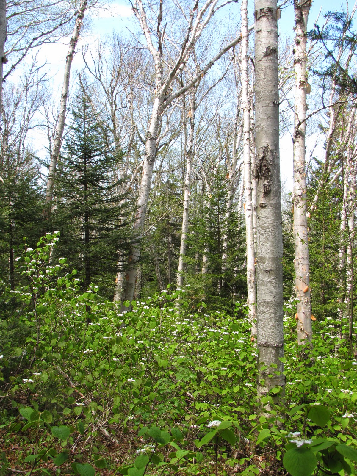
A stand of Moose Hobble

And there was wildlife too.  I heard a steady chorus of rat-tat-tats from woodpeckers and dull drumming from partridge, but never saw them.  Nor did I see the moose that I startled at a bend in the trail.  But I was able to get photos of a chattering red squirrel and an elusive Hermit Thrush:


I had planned to eat my lunch at the summit -- and I did, but I hadn't planned to be so mesmerized by the views.  I lingered there awhile!
To the north is civilization (and a huge scar on the landscape from Cassella's landfill in Bethlehem.)  I won't post a picture of it.  But to the east and west are the Twin and Franconia Ranges.  And to the south is the Pemi Wilderness ---- spectacular!!!!!!!!

North and South Twin.  The speck at center-right is the Galehead AMC hut
The "back side" of the Franconia Range

The Pemi Wilderness with Owl's Head featured ever so prominently.

But now it's time to leave the summit.  Here's a short video clip to give you a feel for the hike down:

Oops, Blogger won't process the video.  Sorry.


Wednesday, May 21, 2014

71>71 --- Tecumseh May 21, 2014 (Finally,back at it)

Wednesday May 21st, 2014

Today I got out for my first 4000 footer hike of the season.  What a great feeling.
I did start small ----- Tecumseh is one of the two lowest NH 4000 footers.  Relative little elevation gain and just five miles total distance.  Two years ago after doing Tecumseh as my first of the season I had to pull to the edge of the road while driving home because I got a cramp in my leg.  Not so this year.  I'm reading that to mean I'm in better shape now than I was two years ago.  But, before I get to cocky,  I better see how I feel tomorrow morning!
I have just 20 peaks left to finish my 71 four thousand footers after age 71 list.  I'm feeling pretty confident that I can complete the list between now and October (12 to 14 hikes will hit all 20 summits.)
This is an especially pleasant time of year to be out in the woods.  The air is still cool, there are few bugs yet, and every thing is young and breaking out with exuberance --- young leaves of every shade of green, bold flower blossoms, animals scurrying, birds chirping.  Here are a few photos of today's hike:

Yes, it was a beautiful day.

Trout Lilies


Trillium

Moose Hobble

Probably the work of a Pileated 


Tecumseh's summit through the trees at about the half way point.  They're never as distant as they appear!  Just keep plodding along.

Quirky trail sign


Tecumseh summit
Tripyramids

Osceolas